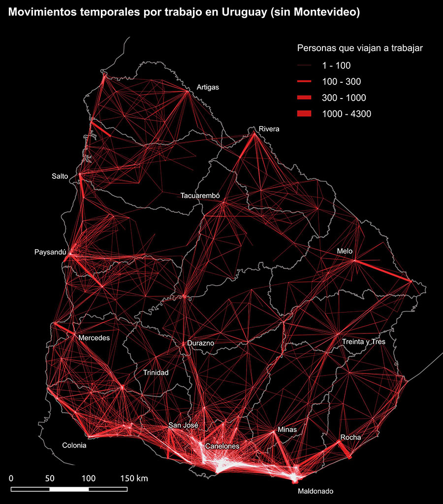
Mid-distance commuters in Uruguay
Techstack
- R
Tools
- QGIS, Google Distance Matrix API
Pendular movements from census data
This map is part of a series of maps and spatial data-analysis of the daily commutes in my home country, Uruguay, for which I have done a research project related to decentralization and functional areas.
Using national census data, I mapped what geographers call the “pendular movements” of commuters: Every line on the map represents a commuter, or someone who travels relatively long distances in order to get to their job or educational facility on a daily basis.
As expected, you’ll see a cluster of intense daily commutes in the southern coastal zone, close to the capital city, the biggest urban center of the country.