Web scraping real-estate geocoded data
Techstack
- Python, Selenium
Tools
- QGIS, Jupyter Notebooks
Extracting data from the web
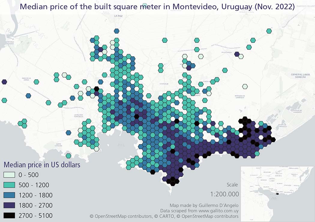
I made a Python script, based on Selenium, to scrape geocoded data of a real-estate website, generating a layer of more than six thousand points. Then I aggregated the data in a hexagonal grid of polygons to map the median prices of built-square-meters in the city of Montevideo, Uruguay.
The combination of web scraping with geospatial data-analysis and visualization is a very powerful way to analyze spatial processes and deliver insights in urban contexts.